Origin and Geological Formation
The volcanic history of Piton des Neiges
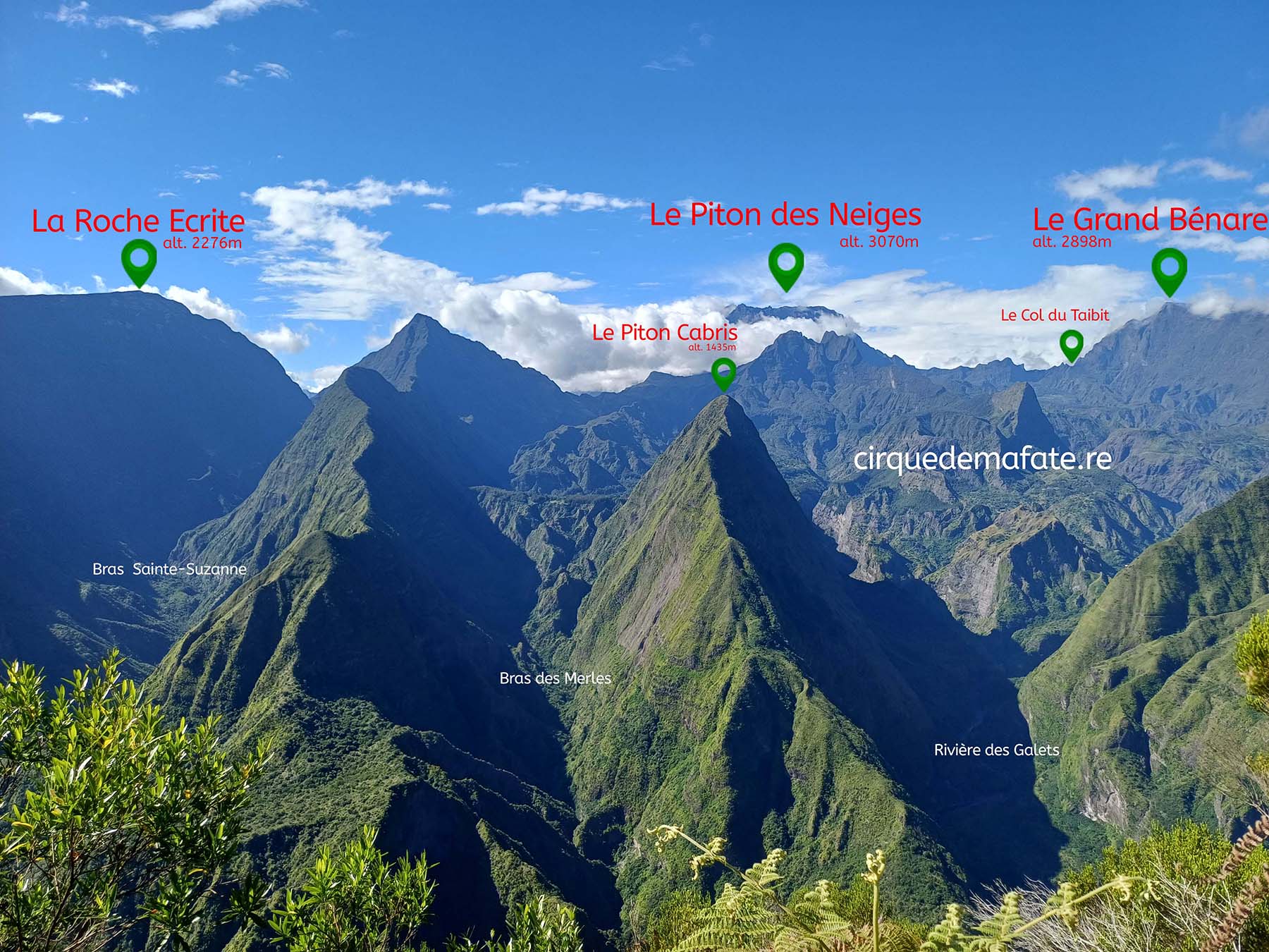
The Cirque de Mafate originates from the volcanic history of Réunion Island. It was formed several hundred thousand years ago following the gradual collapse of Piton des Neiges (alt. 3,070 m – the highest peak on the island and in the Indian Ocean), an extinct volcano. This geological process, known as volcanic erosion, has profoundly shaped the island’s landscape.
The role of erosion and tropical climate
Over time, tropical rains, winds, and rivers have carved the rock, creating a spectacular landscape made up of steep cliffs, deep ravines, and isolated plateaus. Unlike other volcanic formations, Mafate was not formed by a sudden eruption, but by a slow process of erosion that has shaped the cirque as we know it today.
Relief and isolation
A rugged and natural terrain
This rugged terrain has helped to naturally isolate the cirque from the rest of the island. Surrounded by steep mountains and with no road access, Mafate has become a remote and hard-to-reach area, preserved from modern development. This unique geography has played a key role in its human history, making it a natural refuge for people seeking isolation.
Today, the formation of the Cirque de Mafate reflects the power of natural forces that have shaped Réunion Island. This exceptional landscape, formed over millions of years of geological evolution, offers a unique setting where nature, history, and isolation come together.
The geographical diversity of the Cirque de Mafate supports unique habitats for many endemic species, contributing to its exceptional ecological richness.
Formation of hamlets and trails
The terrain has given rise to several hamlets and spectacular trails, accessible only on foot or by helicopter. These paths connect the communities while preserving the territory’s untouched character.
The trails in the cirque offer breathtaking views of the cliffs and ravines, highlighting the site’s unique geography for hikers and visitors.